The Virgin Islands National Park has some of the most beautiful beaches in the world, incredible snorkeling, hiking, varied wildlife, and an important history. In 2017, hurricanes Irma and Maria hit St. John island and took a toll on the infrastructure and economy. The island and park are still rebuilding, but St. John and the Virgin Islands National Park are still beautiful and absolutely worth visiting.
(Full photo slideshow at bottom of post)
Map of the Virgin Islands National Park here
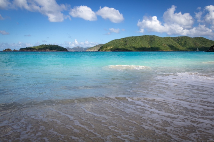
Cinnamon Beach
One of the most stunning beaches in the Virgin Islands National Park is Cinnamon Beach, with white sand, bright water, and slopes of islands in the distance.
Follow the North Shore Road past Trunk Bay and arrive at Cinnamon Bay and Beach. The Cinnamon Bay Factory Ruins can be reached by a wheelchair accessible boardwalk. Cinnamon Bay itself has clear blue waters and great snorkeling.
St. John History Note: Cinnamon Bay was once the site of a Tiano settlement*, as shown by archeological excavations. The Tiano people are indigenous to the Caribbean and St. John Island. When the Danes colonized the island, they reported it to be uninhabited. The Tiano people were established on St. John for a long period of time, but seem to have either left the island, been driven off, or wiped out. You can read more about the Tiano people and their history here.
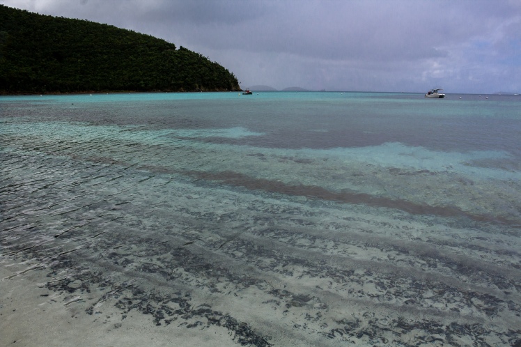
Snorkeling at Maho Bay
Maho Bay, just a little farther up the North Shore Road than Cinnamon Beach, offers protected and beginner snorkeling. It’s also a great spot to swim with sea turtles and sting rays. Just remember not to touch or chase turtles or rays!
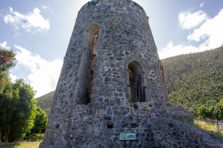
Annaberg Sugar Plantation
When the Danes colonized the US Virgin Islands, they established sugar plantations and brought hundreds of people over from Africa to work as slaves. The Annaberg Sugar Plantation serves as a reminder of uglier history of the island. The plantation overlooks the Sir Fancis Drake Channel, dividing the US Virgin Islands from the British Virgin Islands. The British Virgin Islands abolished slavery before the then Danish Virgin Islands, so slaves would often flee to Tortola across the channel. Some would use a canoe, some brave souls would swim, and sometimes people in Tortola would coordinate and organize a boat to take people away from St. John and to the British Virgin Islands. *
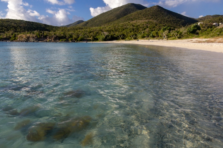
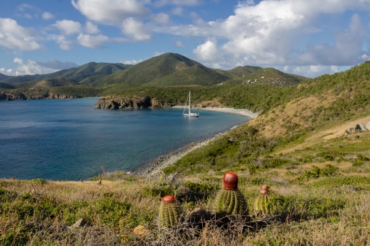
Snorkeling Salt Pond Bay
The Southeast point of St. John Island is more arid and desert-like than the jungle that lines the North Shore, but is every bit as interesting. Salt Pond Bay is a beautiful sheltered beach and a good snorkel spot, about a quarter mile from the parking lot. Follow any one of the small trails from the beach and you’ll reach the Salt Pond, a salt pond with thousands of tiny crabs. In dryer months, the salt crystalizes at the ponds edge.
Ram’s Head Hike
The hike out to Ram’s Head, or the southernmost point on the island, is about three miles, moderate to strenuous, and gorgeous. If you walk to the end of Salt Pond Bay Beach, you’ll find a trail that begins to lead South. Follow that trial until you get to a rocky beach, where the trail will seem to disappear. The trail resumes at the end of the beach.
The hike ends at Rams Head, where to the East you can feel the full force of the Atlantic and the Easterly Trade Winds. To the West a protected bay and calm turquoise water. It’s a strange juxtaposition, and really can help you understand the power and variety of the ocean, and how remarkable it is that an island can hold so much life in the middle of the ocean, a blue desert.

Waterlemon Cay
Waterlemon Cay has beautiful hiking, great snorkeling, and is the best place to see some Virgin Islands National Park wildlife. The trailhead begins at the Annaberg Sugar Plantation parking lot, and it is about a mile to the first bay. Here, we saw nurse sharks swimming in the shallows, and sea urchins. The Johnny Horn Trail begins on this beach, so if you’d rather hike than swim you can go check out the two different ruins at the top. Farther down this beach, it will look like the beach ends and turns to large rocks. If you scramble over these rocks, you will reach a smaller, rocky beach which makes a good launch spot for Waterlemon Cay. (Yes, that’s Waterlemon, not Watermelon). It isn’t a far snorkel out to the Cay, but it’s important to note that there can be a really strong current between mainland and the Cay, so it’s definitely not a good trip for everyone. I preferred to hike rather than think about being dragged out to sea and becoming fish food.

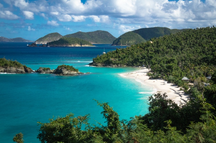
Trunk Bay Snorkel Trail
Trunk Bay is the most popular beach in the park, and most of the cruise ship passengers stop here. Still, popular things are popular for a reason, so I would recommend a trip out in the early morning or late afternoon, before or after the crowds. At Trunk Bay you can rent snorkel equipment if you don’t have your own, and hit the Virgin Islands National Park’s underwater snorkel trail to learn more about reef systems!
*Historical Information from St. John Off the Beaten Track: A Photographically Illustrated Guide to St. John, US Virgin Islands, Gerald Singer (Purchase here)
Where to Next?
Sea Kayak the caves of the Apostle Islands National Lakeshore
Explore Kentucky’s Red River Gorge
Visit Michigan’s Sleeping Bear Dunes
Remember to throw your email in my email list, or follow my blog with Bloglovin!


Madeline, Is there a visitors center to get a National Parks Passport book stamped? Thanks, Frank
Sent from Mail for Windows 10
________________________________
LikeLike
Hi Frank!
There is! On St. John the National Park visitor’s center is in Cruz Bay, right at the beginning of the North Shore Road. You can’t miss it! The 20 (North Shore Road) is one of the only roads on the island, so it’s harder to get lost than it looks when you get there!
Good luck!
-Maddy
LikeLike
Awesome Madeline!!
LikeLiked by 1 person
I visit the USVI and BVI frequently and it never ceases to amaze me 😉
LikeLiked by 1 person
SUCH a pretty place! I didn’t make it over to the BVI but hopefully next time!
LikeLike
Looks amazing!
Many thanks for stopping by my Travel and Photography blog.
LikeLiked by 1 person
❤️❤️❤️
LikeLiked by 1 person